1
We combine advanced GIS technology with LiDAR, survey, and GPR data to build geospatially accurate BIM models and interactive site maps. By seamlessly integrating essential APIs—like Land Use Capability and Flood Hazard mapping—alongside our automated document parser and report generator, we give you the complete picture from day one. The result? You reduce cost, time, and safety risks by identifying critical assets and environmental factors early, all delivered through practical, easy-to-understand visuals and comprehensive reports.
2
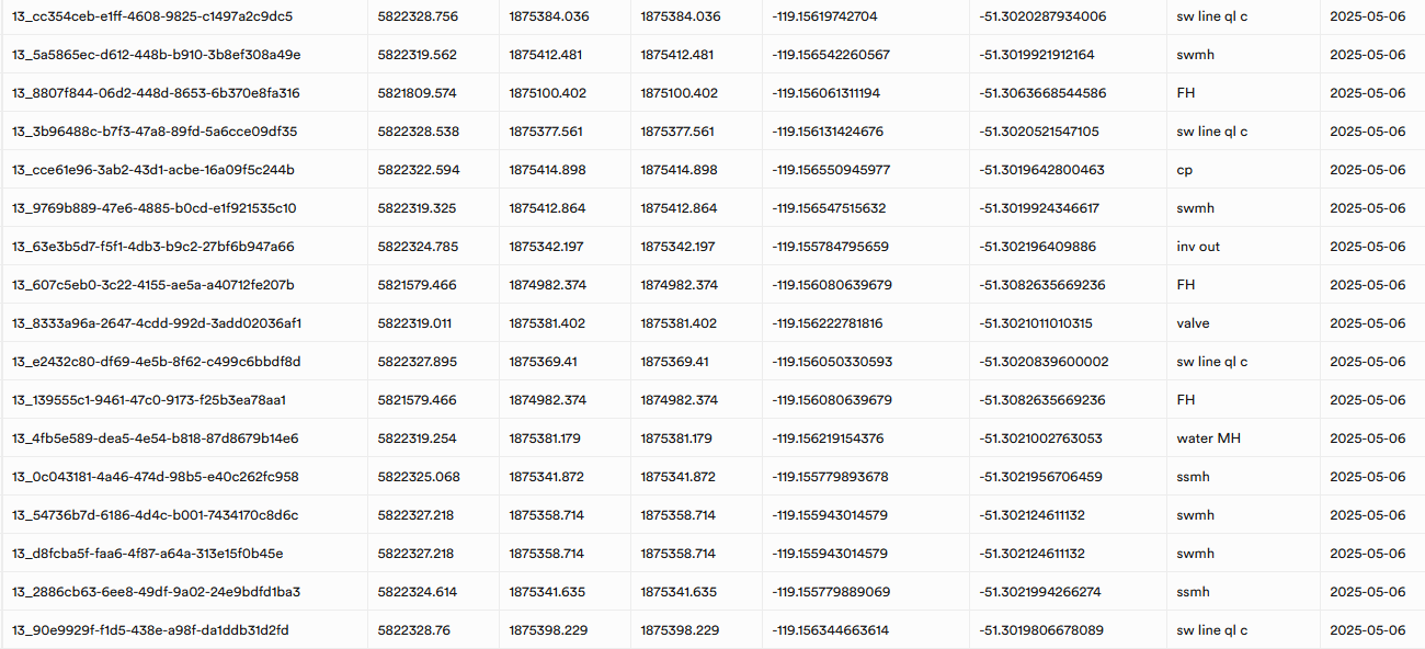
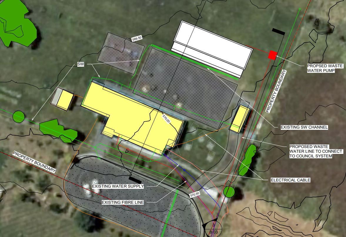
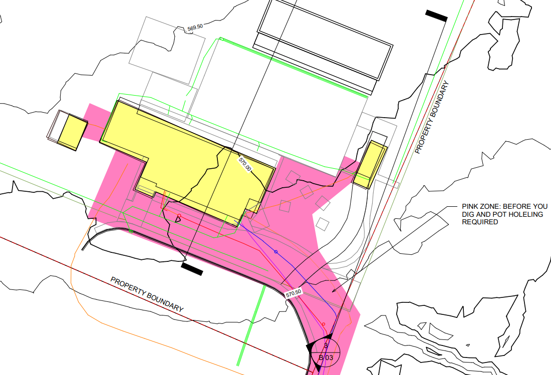
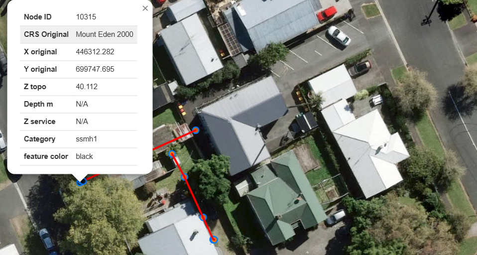
No more guessing where underground utilities are. We develop spatially correct drawings and flag high risk zones that are persistent and exist long after traditional GPR spray paint has vanished.
3
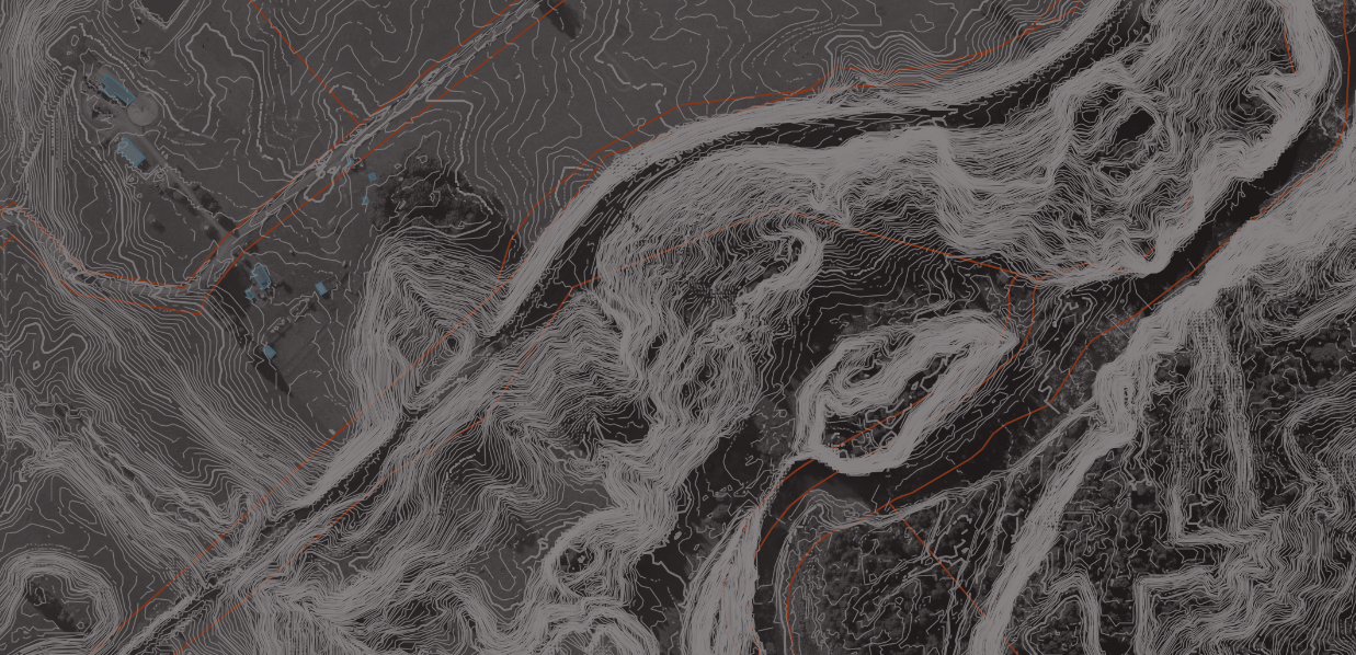
Test ideas and concepts with accurate topography without the cost of a traditional site survey.
4
Share interactive maps with the team to show hidden utilities, photos, hazard maps, contours and documents with their metadata.
5
Contact our team to build custom databases and interactive maps for asset management.